Go to: OVERVIEW
(SaveOurCounty) DETAILS
(listener)
PLANNING SCHOOLS ENVIRONMENT EROSION
Report corrections & broken links to Webmaster Get updates on local issues
Road
Information
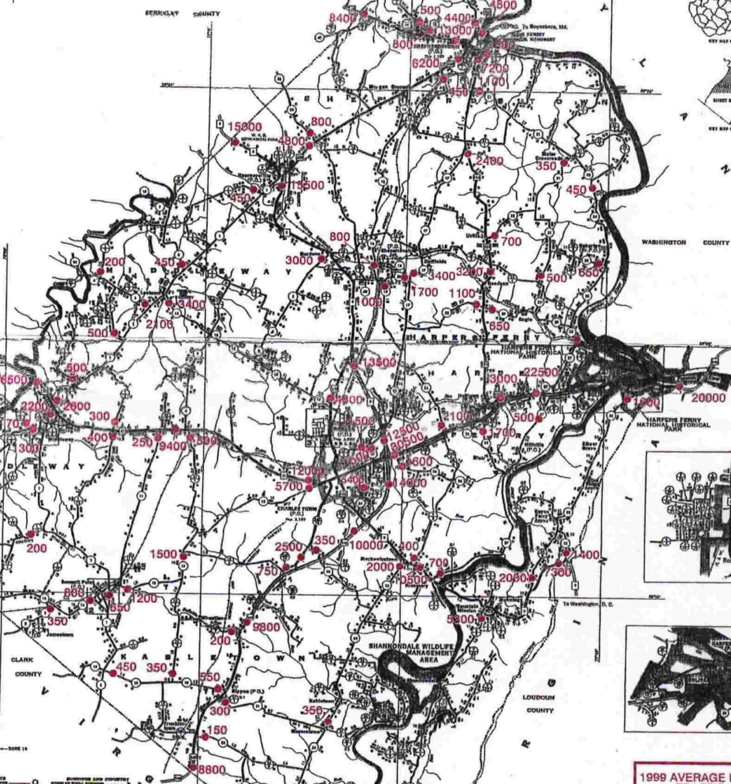
Map of daily total
traffic on each road, Oct 2005 PDF file (1,929k);
be patient while it loads. Peak rush hour is usually about 10% of daily
total.
Map of daily total
traffic on each road, Oct 1999 JPG file (256k);
be patient while it loads. If you leave your cursor on the map for several
seconds, a magnification button will appear. Click it.
Publications &
videos on how to repair & maintain Roads
How to calm the
traffic Example on route 50 in
Virginia
Roads don't have to
break up wildlife areas
Why we need more
dirt roads
(& song)
County ordinance requiring street numbers on houses & long driveways
Road cleanup: Keep Jefferson Beautiful
State Division
of Highways:
Current road conditions
Route 9: Arguments for wider road: government
State road Maintenance:
potholes, snow, mowing, etc. 725-5821 Leetown
State road Construction:
800-642-9292 or 304-558-3505 Charleston
State road Re-design:
traffic lights, turn lanes, speed limits, etc. 304-289-3521 Burlington
State road traffic Accidents
304-558-3063 Charleston
State road traffic Counts
304-558-9620 Charleston
(Speed limits are
based on: curves, number of entrances, and 80th percentile of the
speeds that drivers actually go, not on any effort to keep roads peaceful or
protect farm equipment. Sheriff's deputies rarely have time for speed
enforcement anyway.)
Projections
A traffic study was
done for Jefferson, Berkeley and Washington Counties by several consultants,
following national DOT standards for such studies. The study documents are no
longer on the web. Ask if you
need them
Page 10 of the file
says they are assuming 66% total population growth over 30 years in Jefferson
& Berkeley counties, and 53% in Washington county. These are outside groups'
projections of our overall growth (I'm waiting to hear the exact source). They
used local planning figures to estimate where this would be, but not the total
growth.
The study assumes no
change in trips per person over the next 30 years, though they said there has
been substantial growth in trips per person in the past 30 years.
Page 14 shows
through-traffic from outside the region (340, 9, and Interstates).
Through-traffic will more than double on rt 9 at Harpers Ferry; with lesser
increases everywhere else.
Page 19 shows $100
million spent on roads & bridges in Jefferson County so far (they don't say
since when), and $105 million in the next 6 years. Much more than the other 2
counties together.
Page 24 says that in
2000, two thirds of vehicle-miles were at level of service C or better. Level C
means traffic flows with some delays.
Page 24 says that
after the projected 66% population growth, and the $105 million in road
construction, then in 2030 two thirds of vehicle miles will be level D or worse
(substantial delays).
The consultants also have a summary of the meetings For rt 340 at Harpers Ferry, the summary suggests considering "reversible lanes" to allow only one-way traffic during rush hour, and "other alternative measures" (car pool only, like I-66? paying through a transponder like the Dulles toll road?)